The Butts, Brandon Rubble and The Grindle.
The Butts
Since medieval times when longbow practice was compulsory, part of this wetlands area of the town near the Westgate was also known as The Butts. This refers to the target an archer fired at. Once a national sport, archery won the battle of Agincourt.
The Westgate, pulled down in July 1765, stood where today the roundabout is situated.
Also here was the dubiously named, Hellfire Cottages along with Butts Place. An apocryphal story why Hellfire Corner came to be so dubbed, was that the future vicar of St Peters church, before it was consecrated in 1858, used to hold open air services in the nearby water meadows, preaching “hellfire and damnation” to those who didn’t repent!
The water meadows were reached via a small lane called Cullum Road which finished at what is today Corsbie Close, built on the former Atlas Engineering Works site. A relief road linking southern Bury was created in 1972, with Cullum Road no longer a small lane!
The Cullum family owned Hardwick Hall, their name cropping up time and time again. In creating the Parkway at the rear of St Peters Church in 1977 a Victorian rubbish dump was uncovered, bottle and pot lid collectors descended in their droves.
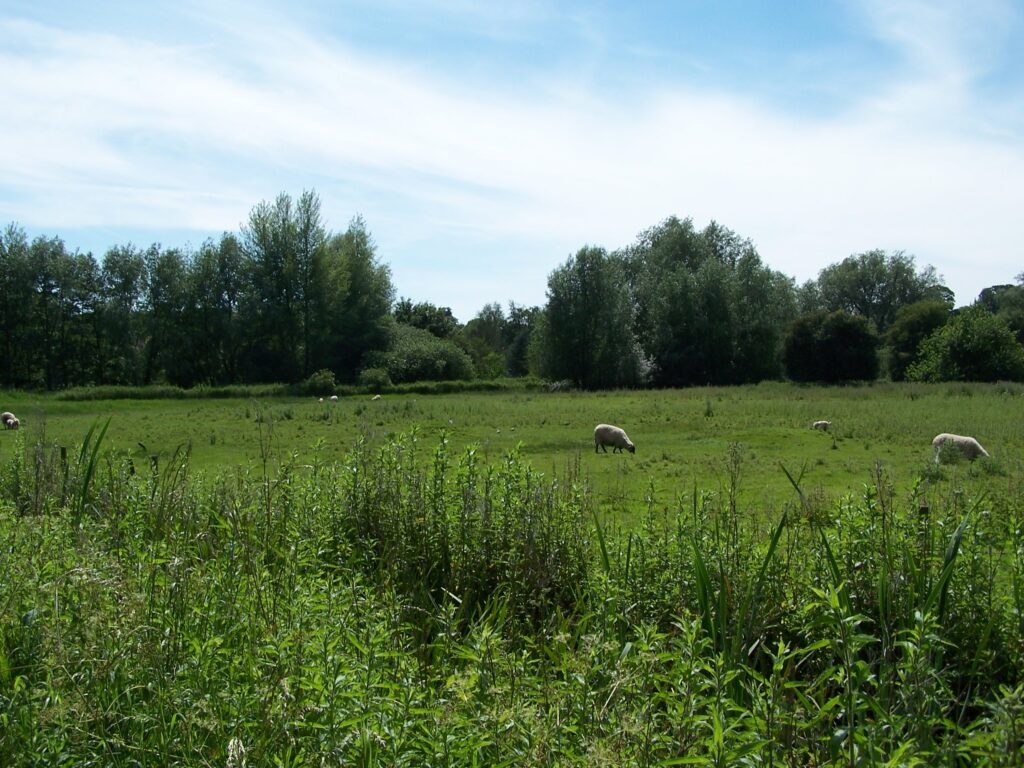
Criss-crossed by small track ways and footpaths, ditches and riverlets, the boundary of the water meadow is the river Linnet which rises in Ickworth Park. Close to the Linnet are Holywater Meadows, a nearby Close is called Holywell; however nothing to do with religion but a spring once called The Holewell! Just a few minutes away from the town centre, the Butts has a countryside feel to it.
Brandon Rubble
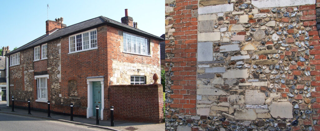
After the dissolution of St Edmundsbury Abbey in 1539, the site became a builder’s merchants for the people of the town, the limestone a valuable resource for properties. It is said you that will find the abbey stone all over the town but not any further than six miles outside it; the distance covered by a cart and oxen there and back in a day. The greatest recycle of this robbed stone is that in a wall by the Farmers Club in Pump Lane measuring approximately 100ft long by nearly 6ft high! This wall is not made up of odd pieces, but actual blocks!
Much more of it, and there was a huge amount has been re-used in cellars of the town. One thing that is noticeable as you walk around the “historic core” of Bury is walls consisting of pieces of brick, limestone and flint. I once asked a builder friend of mine, “John, what do you call that type of wall construction”. He replied “Brandon rubble”. I assumed Brandon rubble because of the high flint content. Brandon a town 15 miles to the north of Bury famous for flint knapping, a skill that was still in use to provide flints for muskets up till only a few years ago.
Now when I started as a tour guide several years ago I would tell the punters, of the usage of the abbey stone, Brandon rubble. However on about the fifth tour I did, my wife was with some friends I was taking round the town. On relating the story of Brandon rubble to these friends, she pulled me to one side and said “What did you call that type of wall”. I replied what my mate John had told me, Brandon rubble. “No he didn’t cloth ears, he called it RANDOM RUBBLE”. Now that’s a true story.
The Grindle
This area of Bury St Edmunds is just off Beech Rise/Southgate Street. There are different theories as to why it was called The Grindle. That fine cartographer of Bury, Thomas Warren shows on his map of 1747 the Grindle linking from near the South Gate through to York Bridge and Fryers Lane.
Could this have been part of the town’s medieval defences protecting the Southgate suburb? After all, a mound that once formed part of the Grindle would have made a good, fortified position. Was it possible that Grindle derived its name from the word Grinn meaning fortress? According to the Oxford dictionary of Place Names, Grindle also means green hill.
The antiquarian Edmund Gillingwater in his 1804 book “An historical descriptive account of the ancient town of St Edmundsbury” has it as a “place of security for cattle and other necessaries”. This was in the days when Bury was thought to have its origins as the site of a Roman settlement, the Villa Faustini. We now know this is not the case. Apart from a few shards of pottery thought to be Roman found in the building of the residential home 11, Cullum Road and a small development at Plumptons Yard, Saint Andrews St South there is no evidence of Roman occupation in Bury.
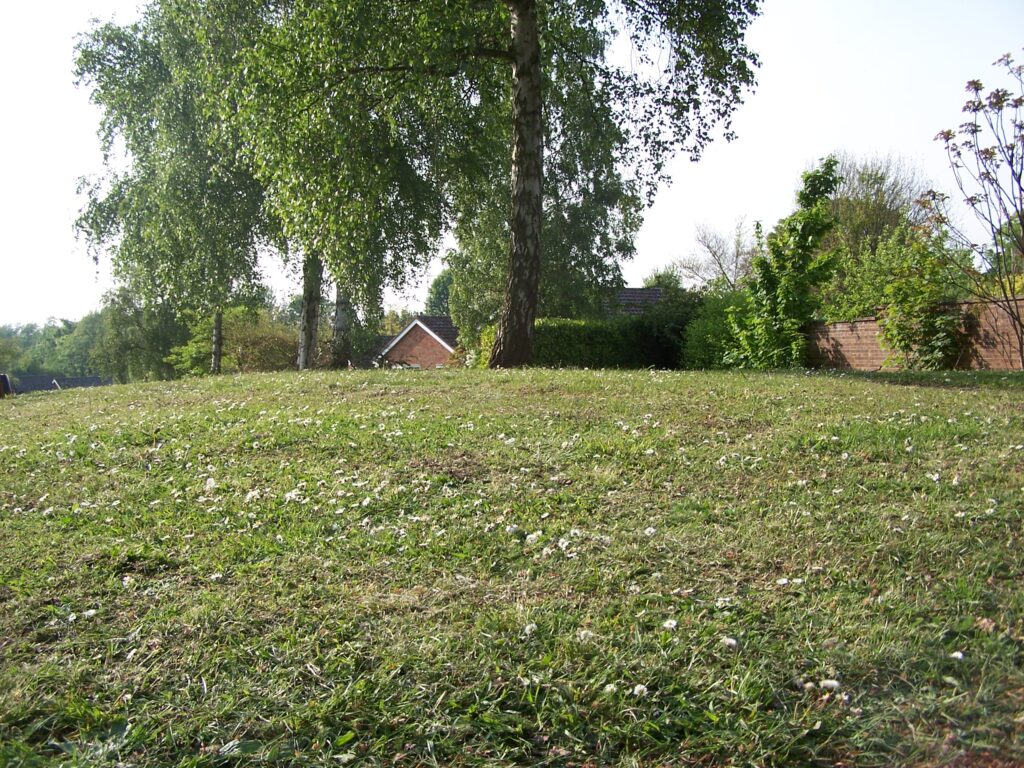
In 1962 an archaeological dig was carried out by volunteers at the Grindle under the guidance of Moyses Hall, nothing was found, disproving the ancient theories. Housing was built soon after appropriately known as Grindle Gardens.
An area known as “Grindle Paddocks” is set aside as a nature reserve, a leftover from Redrow Homes nearby off Southgate Street. The “Paddocks” have watercourses running through it straddled by York Bridge; some of the more diverse inhabitants are crested newts and water voles.
With thanks to Martyn Taylor and taken from his book Secrets of Bury St Edmunds.